


 |
Adjudication BoundaryNarrative Description of the
Adjudication Boundary for the
Zuni River Basin, New Mexico
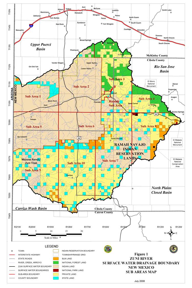
The adjudication boundary for the Zuni River Basin, New Mexico, includes the mainstem Zuni River and all tributaries that contribute water to the Zuni River. The Zuni River Basin, New Mexico, is contained entirely within the Counties of Cibola and McKinley, New Mexico. The general legal description of the adjudication area, as portrayed in the map entitled "ZUNI RIVER SURFACE WATER DRAINAGE BOUNDARY MAP" is as follows:
For a larger version of image click here
To view the legal description click here
Downloading Adobe Files
The documents on this page are provided in
Portable Document Format (PDF). Users may need to download and install
Adobe Acrobat Reader to view and print these documents. This is free
software available from Adobe.

|
|
Disclaimer
The United States Department of Justice and Bureau of Indian Affairs makes every effort to ensure that all the technical data and information made available to the public through this web site are accurate, timely, and complete. Neither the Department of Justice, the Bureau of Indian Affairs, nor the web site creator, however, assume any legal responsibility for the accuracy, timeliness, or completeness of the information contained on this site. Persons using information from this site for official purposes or other purposes, for which accuracy, timeliness, and completeness are required, are hereby notified that they should first verify the information with the Department of Justice, the Bureau of Indian Affairs, public records, or other primary sources from which the information was obtained.
Back to the Top |